
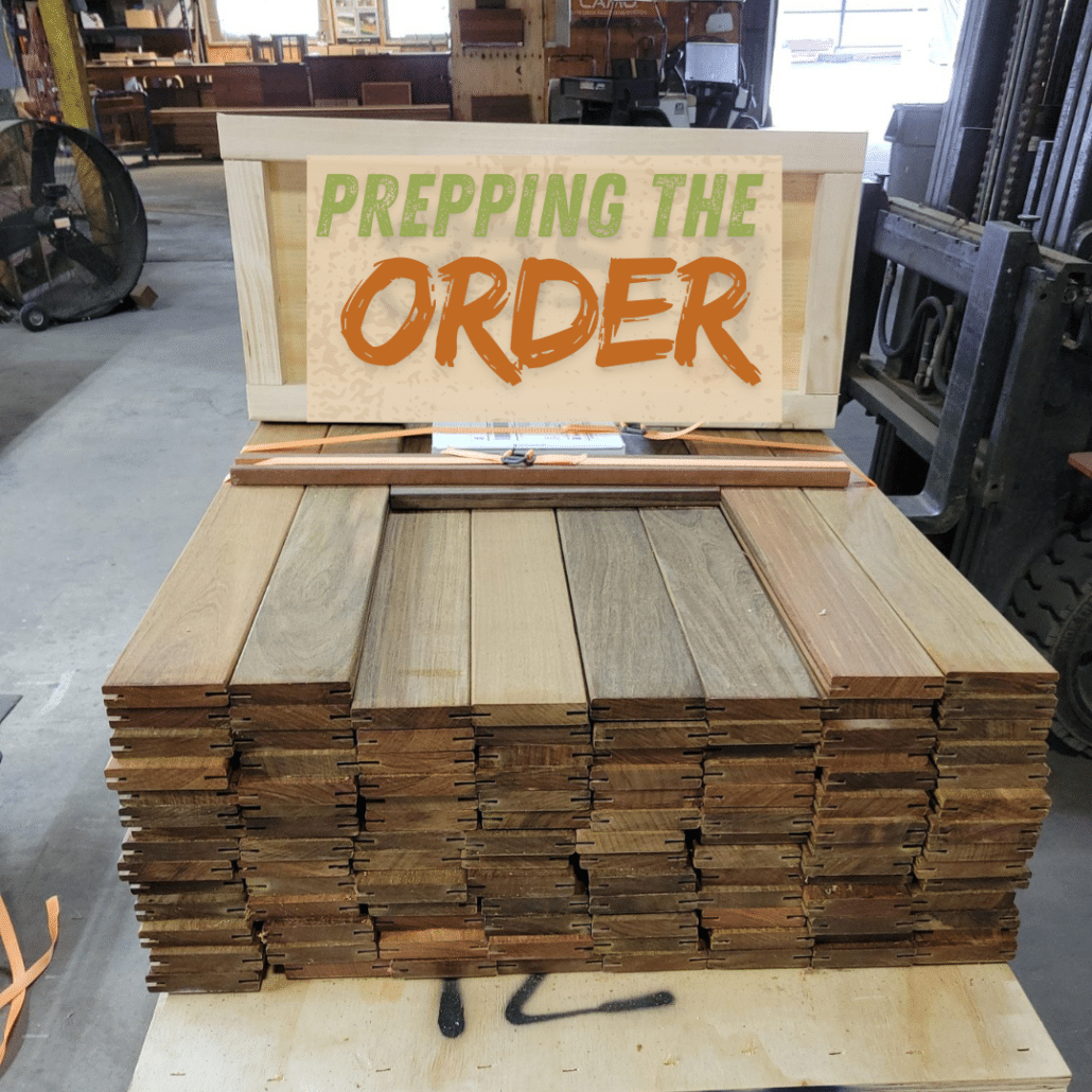
Ipe 1×4 Grooved Decking Delivered to Chicago, IL – Fully Crated and Damage-Free
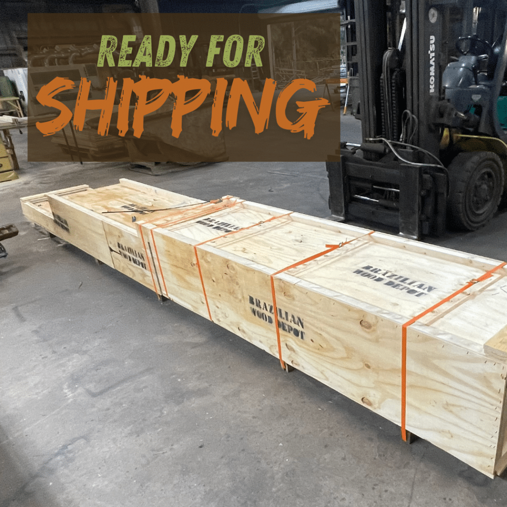
Every shipment we send from Atlanta is fully crated and packaged to withstand long-haul transport, ensuring our customers receive their materials in flawless condition. This recent delivery of Ipe 1×4 grooved decking to Chicago, Illinois showcases our commitment to speed, protection, and precision — arriving in under one week and backed by our zero-damage guarantee.
Using our GPS tracking system, we documented the shipment’s full route from Georgia through Tennessee and Kentucky before reaching the greater Chicago area. Whether you’re a homeowner or contractor, you can trust that our Brazilian hardwood decking — including Ipe, Cumaru, Tigerwood, and Garapa — always arrives safe, secure, and ready to install.
Explore the interactive delivery map to follow this shipment’s complete journey from Atlanta, GA to Chicago, IL. Each pin along the route marks a GPS-tracked checkpoint, recorded in real time.
Click on any pin to view the exact date, time, and location of the truck as it made its way north. This transparent tracking system reflects Brazilian Wood Depot’s commitment to fast, verifiable, and damage-free delivery — from our yard to your jobsite.
Important Disclaimer: The customer’s exact delivery address is never displayed on the map—only the shipment route.
Click to See All the GPS Data for This Shipment
| timestamp | address | location | accuracy_in_meters |
| 3/18/2025 13:16 | 6822 Buford Highway, Doraville, GA 30340 | https://maps.google.com/maps?q=33.925298,-84.24415 | 26000 |
| 3/18/2025 13:26 | 6822 Buford Highway, Doraville, GA 30340 | https://maps.google.com/maps?q=33.925838,-84.244208 | 26000 |
| 3/18/2025 13:37 | 2654 Weaver Way, Doraville, GA 30340 | https://maps.google.com/maps?q=33.925068,-84.243838 | 29000 |
| 3/18/2025 13:47 | 6822 Buford Highway, Doraville, GA 30340 | https://maps.google.com/maps?q=33.92623,-84.245062 | 13000 |
| 3/18/2025 13:57 | 6822 Buford Highway, Doraville, GA 30340 | https://maps.google.com/maps?q=33.926287,-84.244883 | 10000 |
| 3/18/2025 14:07 | 6822 Buford Highway, Doraville, GA 30340 | https://maps.google.com/maps?q=33.92572,-84.245012 | 15000 |
| 3/18/2025 14:17 | 6704 Buford Highway, Doraville, GA 30340 | https://maps.google.com/maps?q=33.926895,-84.243335 | 13000 |
| 3/18/2025 14:28 | 6802 Buford Highway, Doraville, GA 30340 | https://maps.google.com/maps?q=33.925493,-84.245595 | 14000 |
| 3/18/2025 14:38 | 6822 Buford Highway, Doraville, GA 30340 | https://maps.google.com/maps?q=33.925877,-84.244693 | 11000 |
| 3/18/2025 14:48 | 6822 Buford Highway, Doraville, GA 30340 | https://maps.google.com/maps?q=33.925482,-84.244907 | 15000 |
| 3/18/2025 14:58 | 6822 Buford Highway, Doraville, GA 30340 | https://maps.google.com/maps?q=33.926168,-84.243742 | 15000 |
| 3/18/2025 15:08 | 4478 Peachtree Street, Atlanta, GA 30340 | https://maps.google.com/maps?q=33.926393,-84.246827 | 25000 |
| 3/18/2025 15:19 | 6000 Dawson Boulevard, Gwinnett County, GA 30093 | https://maps.google.com/maps?q=33.907215,-84.207162 | 20000 |
| 3/18/2025 15:28 | 5625 Oakbrook Parkway, Norcross, GA 30093 | https://maps.google.com/maps?q=33.919523,-84.190737 | 20000 |
| 3/18/2025 15:38 | 5625 Oakbrook Parkway, Norcross, GA 30093 | https://maps.google.com/maps?q=33.9197746,-84.1902901 | 30000 |
| 3/18/2025 15:49 | 5625 Oakbrook Parkway, Norcross, GA 30093 | https://maps.google.com/maps?q=33.9199639,-84.1904807 | 52000 |
| 3/18/2025 15:59 | 1740 Indian Trail Lilburn Road, Norcross, GA 30093 | https://maps.google.com/maps?q=33.926087,-84.174428 | 20000 |
| 3/18/2025 16:09 | University Parkway, Lawrenceville, GA 30044 | https://maps.google.com/maps?q=33.960913,-84.065513 | 21000 |
| 3/18/2025 16:20 | 660 Buford Drive, Lawrenceville, GA 30046 | https://maps.google.com/maps?q=33.97861,-83.986268 | 18000 |
| 3/18/2025 16:30 | Hosea Road, Lawrenceville, GA 30046 | https://maps.google.com/maps?q=33.966505,-83.969097 | 24000 |
| 3/18/2025 16:40 | Boulderbrook Circle, Lawrenceville, GA 30045 | https://maps.google.com/maps?q=33.972388,-83.94912 | 17000 |
| 3/18/2025 16:51 | 50 Boulderbrook Circle, Lawrenceville, GA 30045 | https://maps.google.com/maps?q=33.972988,-83.9501 | 25000 |
| 3/18/2025 17:01 | 50 Boulderbrook Circle, Lawrenceville, GA 30045 | https://maps.google.com/maps?q=33.973235,-83.950013 | 24000 |
| 3/18/2025 17:12 | 50 Boulderbrook Circle, Lawrenceville, GA 30045 | https://maps.google.com/maps?q=33.973358,-83.94993 | 25000 |
| 3/18/2025 17:21 | 50 Boulderbrook Circle, Lawrenceville, GA 30045 | https://maps.google.com/maps?q=33.973113,-83.949997 | 24000 |
| 3/18/2025 17:31 | 50 Boulderbrook Circle, Lawrenceville, GA 30045 | https://maps.google.com/maps?q=33.973173,-83.949683 | 27000 |
| 3/18/2025 17:42 | 50 Boulderbrook Circle, Lawrenceville, GA 30045 | https://maps.google.com/maps?q=33.973243,-83.949872 | 21000 |
| 3/18/2025 17:51 | 50 Boulderbrook Circle, Lawrenceville, GA 30045 | https://maps.google.com/maps?q=33.973125,-83.95008 | 21000 |
| 3/18/2025 18:02 | 50 Boulderbrook Circle, Lawrenceville, GA 30045 | https://maps.google.com/maps?q=33.97292,-83.950467 | 21000 |
| 3/18/2025 18:11 | 50 Boulderbrook Circle, Lawrenceville, GA 30045 | https://maps.google.com/maps?q=33.972682,-83.950279 | 15000 |
| 3/18/2025 18:22 | 50 Boulderbrook Circle, Lawrenceville, GA 30045 | https://maps.google.com/maps?q=33.973252,-83.949922 | 26000 |
| 3/18/2025 18:32 | 50 Boulderbrook Circle, Lawrenceville, GA 30045 | https://maps.google.com/maps?q=33.972833,-83.950123 | 29000 |
| 3/18/2025 18:42 | 50 Boulderbrook Circle, Lawrenceville, GA 30045 | https://maps.google.com/maps?q=33.9734,-83.950648 | 22000 |
| 3/18/2025 18:53 | 50 Boulderbrook Circle, Lawrenceville, GA 30045 | https://maps.google.com/maps?q=33.973613,-83.950625 | 21000 |
| 3/18/2025 19:03 | 50 Boulderbrook Circle, Lawrenceville, GA 30045 | https://maps.google.com/maps?q=33.97317,-83.950493 | 20000 |
| 3/18/2025 19:13 | 50 Boulderbrook Circle, Lawrenceville, GA 30045 | https://maps.google.com/maps?q=33.973293,-83.950273 | 23000 |
| 3/18/2025 19:23 | 50 Boulderbrook Circle, Lawrenceville, GA 30045 | https://maps.google.com/maps?q=33.973317,-83.950573 | 18000 |
| 3/18/2025 19:34 | 50 Boulderbrook Circle, Lawrenceville, GA 30045 | https://maps.google.com/maps?q=33.973252,-83.950862 | 26000 |
| 3/18/2025 19:43 | 70 Boulderbrook Circle, Lawrenceville, GA 30045 | https://maps.google.com/maps?q=33.97348,-83.950691 | 23000 |
| 3/18/2025 19:54 | 50 Boulderbrook Circle, Lawrenceville, GA 30045 | https://maps.google.com/maps?q=33.972852,-83.950458 | 22000 |
| 3/18/2025 20:05 | 75 Boulderbrook Circle, Lawrenceville, GA 30045 | https://maps.google.com/maps?q=33.974422,-83.949683 | 27000 |
| 3/18/2025 20:15 | 50 Boulderbrook Circle, Lawrenceville, GA 30045 | https://maps.google.com/maps?q=33.973468,-83.950563 | 23000 |
| 3/18/2025 20:24 | 50 Boulderbrook Circle, Lawrenceville, GA 30045 | https://maps.google.com/maps?q=33.973485,-83.950588 | 25000 |
| 3/18/2025 20:35 | 50 Boulderbrook Circle, Lawrenceville, GA 30045 | https://maps.google.com/maps?q=33.973467,-83.950613 | 24000 |
| 3/18/2025 20:44 | 70 Boulderbrook Circle, Lawrenceville, GA 30045 | https://maps.google.com/maps?q=33.97348,-83.950691 | 28000 |
| 3/18/2025 20:55 | 50 Boulderbrook Circle, Lawrenceville, GA 30045 | https://maps.google.com/maps?q=33.973177,-83.950062 | 27000 |
| 3/18/2025 21:05 | 70 Boulderbrook Circle, Lawrenceville, GA 30045 | https://maps.google.com/maps?q=33.97349,-83.95075 | 23000 |
| 3/18/2025 21:15 | 70 Boulderbrook Circle, Lawrenceville, GA 30045 | https://maps.google.com/maps?q=33.97352,-83.950877 | 27000 |
| 3/18/2025 21:25 | 50 Boulderbrook Circle, Lawrenceville, GA 30045 | https://maps.google.com/maps?q=33.97321,-83.95045 | 27000 |
| 3/18/2025 21:36 | 50 Boulderbrook Circle, Lawrenceville, GA 30045 | https://maps.google.com/maps?q=33.973408,-83.950442 | 26000 |
| 3/18/2025 21:46 | 70 Boulderbrook Circle, Lawrenceville, GA 30045 | https://maps.google.com/maps?q=33.97348,-83.950691 | 23000 |
| 3/18/2025 21:56 | 70 Boulderbrook Circle, Lawrenceville, GA 30045 | https://maps.google.com/maps?q=33.974048,-83.950515 | 25000 |
| 3/18/2025 22:06 | 975 Mercury Drive, Lawrenceville, GA 30045 | https://maps.google.com/maps?q=33.968552,-83.949647 | 28000 |
| 3/18/2025 22:17 | Boulder Brook Circle, Lawrenceville, GA 30045 | https://maps.google.com/maps?q=33.974702,-83.95053 | 28000 |
| 3/18/2025 22:28 | 50 Boulderbrook Circle, Lawrenceville, GA 30045 | https://maps.google.com/maps?q=33.973102,-83.950837 | 31000 |
| 3/18/2025 22:37 | 70 Boulderbrook Circle, Lawrenceville, GA 30045 | https://maps.google.com/maps?q=33.97348,-83.950691 | 39000 |
| 3/18/2025 22:48 | 50 Boulderbrook Circle, Lawrenceville, GA 30045 | https://maps.google.com/maps?q=33.973257,-83.950512 | 33000 |
| 3/18/2025 22:57 | 70 Boulderbrook Circle, Lawrenceville, GA 30045 | https://maps.google.com/maps?q=33.97348,-83.950691 | 32000 |
| 3/19/2025 0:51 | Winder Highway, Dacula, GA 30019 | https://maps.google.com/maps?q=33.9818825,-83.9292766 | 2830000 |
| 3/19/2025 1:11 | 1686 Cedars Road, Lawrenceville, GA 30045 | https://maps.google.com/maps?q=33.9787747,-83.9469361 | 3893000 |
| 3/19/2025 1:32 | 23 Fern Walk, Lawrenceville, GA 30045 | https://maps.google.com/maps?q=33.9751919,-83.9279676 | 2379000 |
| 3/19/2025 1:42 | 1686 Cedars Road, Lawrenceville, GA 30045 | https://maps.google.com/maps?q=33.9787747,-83.9469361 | 3893000 |
| 3/19/2025 2:33 | 23 Fern Walk, Lawrenceville, GA 30045 | https://maps.google.com/maps?q=33.9751919,-83.9279676 | 2379000 |
| 3/19/2025 2:43 | 1686 Cedars Road, Lawrenceville, GA 30045 | https://maps.google.com/maps?q=33.9787747,-83.9469361 | 3893000 |
| 3/19/2025 3:04 | 23 Fern Walk, Lawrenceville, GA 30045 | https://maps.google.com/maps?q=33.9751919,-83.9279676 | 2379000 |
| 3/19/2025 3:14 | 1686 Cedars Road, Lawrenceville, GA 30045 | https://maps.google.com/maps?q=33.9787747,-83.9469361 | 3893000 |
| 3/19/2025 4:35 | 23 Fern Walk, Lawrenceville, GA 30045 | https://maps.google.com/maps?q=33.9751919,-83.9279676 | 2379000 |
| 3/19/2025 4:56 | 1686 Cedars Road, Lawrenceville, GA 30045 | https://maps.google.com/maps?q=33.9787747,-83.9469361 | 3893000 |
| 3/19/2025 6:38 | 23 Fern Walk, Lawrenceville, GA 30045 | https://maps.google.com/maps?q=33.9751919,-83.9279676 | 2379000 |
| 3/19/2025 6:48 | 1686 Cedars Road, Lawrenceville, GA 30045 | https://maps.google.com/maps?q=33.9787747,-83.9469361 | 3893000 |
| 3/19/2025 7:19 | 175 Alcovy Industrial Boulevard, Dacula, GA 30019 | https://maps.google.com/maps?q=33.9843881,-83.9385845 | 2069000 |
| 3/19/2025 7:29 | 1686 Cedars Road, Lawrenceville, GA 30045 | https://maps.google.com/maps?q=33.9787747,-83.9469361 | 3893000 |
| 3/19/2025 7:39 | 175 Alcovy Industrial Boulevard, Dacula, GA 30019 | https://maps.google.com/maps?q=33.9843881,-83.9385845 | 2069000 |
| 3/19/2025 7:49 | 1686 Cedars Road, Lawrenceville, GA 30045 | https://maps.google.com/maps?q=33.9787747,-83.9469361 | 3893000 |
| 3/19/2025 7:59 | 175 Alcovy Industrial Boulevard, Dacula, GA 30019 | https://maps.google.com/maps?q=33.9843881,-83.9385845 | 2069000 |
| 3/19/2025 8:10 | 1686 Cedars Road, Lawrenceville, GA 30045 | https://maps.google.com/maps?q=33.9787747,-83.9469361 | 3893000 |
| 3/19/2025 8:20 | 175 Alcovy Industrial Boulevard, Dacula, GA 30019 | https://maps.google.com/maps?q=33.9843881,-83.9385845 | 2069000 |
| 3/19/2025 8:30 | 1686 Cedars Road, Lawrenceville, GA 30045 | https://maps.google.com/maps?q=33.9787747,-83.9469361 | 3893000 |
| 3/19/2025 9:01 | 175 Alcovy Industrial Boulevard, Dacula, GA 30019 | https://maps.google.com/maps?q=33.9843881,-83.9385845 | 2069000 |
| 3/19/2025 9:11 | 1686 Cedars Road, Lawrenceville, GA 30045 | https://maps.google.com/maps?q=33.9787747,-83.9469361 | 3893000 |
| 3/19/2025 10:22 | 175 Alcovy Industrial Boulevard, Dacula, GA 30019 | https://maps.google.com/maps?q=33.9843881,-83.9385845 | 2069000 |
| 3/19/2025 10:32 | 1686 Cedars Road, Lawrenceville, GA 30045 | https://maps.google.com/maps?q=33.9787747,-83.9469361 | 3893000 |
| 3/19/2025 11:03 | 175 Alcovy Industrial Boulevard, Dacula, GA 30019 | https://maps.google.com/maps?q=33.9843881,-83.9385845 | 2069000 |
| 3/19/2025 11:23 | 1686 Cedars Road, Lawrenceville, GA 30045 | https://maps.google.com/maps?q=33.9787747,-83.9469361 | 3893000 |
| 3/19/2025 11:34 | 175 Alcovy Industrial Boulevard, Dacula, GA 30019 | https://maps.google.com/maps?q=33.9843881,-83.9385845 | 2069000 |
| 3/19/2025 11:44 | 1686 Cedars Road, Lawrenceville, GA 30045 | https://maps.google.com/maps?q=33.9787747,-83.9469361 | 3893000 |
| 3/19/2025 11:54 | 175 Alcovy Industrial Boulevard, Dacula, GA 30019 | https://maps.google.com/maps?q=33.9843881,-83.9385845 | 2069000 |
| 3/19/2025 12:04 | 1686 Cedars Road, Lawrenceville, GA 30045 | https://maps.google.com/maps?q=33.9787747,-83.9469361 | 3893000 |
| 3/19/2025 12:25 | 689 Winder Highway, Lawrenceville, GA 30045 | https://maps.google.com/maps?q=33.970312,-83.957948 | 3773000 |
| 3/19/2025 12:55 | 175 Alcovy Industrial Boulevard, Dacula, GA 30019 | https://maps.google.com/maps?q=33.9843881,-83.9385845 | 2069000 |
| 3/19/2025 13:05 | 1686 Cedars Road, Lawrenceville, GA 30045 | https://maps.google.com/maps?q=33.9787747,-83.9469361 | 3893000 |
| 3/19/2025 14:27 | 175 Alcovy Industrial Boulevard, Dacula, GA 30019 | https://maps.google.com/maps?q=33.9843881,-83.9385845 | 2069000 |
| 3/19/2025 14:37 | 1686 Cedars Road, Lawrenceville, GA 30045 | https://maps.google.com/maps?q=33.9787747,-83.9469361 | 3893000 |
| 3/19/2025 14:47 | 175 Alcovy Industrial Boulevard, Dacula, GA 30019 | https://maps.google.com/maps?q=33.9843881,-83.9385845 | 2069000 |
| 3/19/2025 14:58 | 1686 Cedars Road, Lawrenceville, GA 30045 | https://maps.google.com/maps?q=33.9787747,-83.9469361 | 3893000 |
| 3/19/2025 15:28 | 175 Alcovy Industrial Boulevard, Dacula, GA 30019 | https://maps.google.com/maps?q=33.9843881,-83.9385845 | 2069000 |
| 3/19/2025 15:38 | 1686 Cedars Road, Lawrenceville, GA 30045 | https://maps.google.com/maps?q=33.9787747,-83.9469361 | 3893000 |
| 3/19/2025 15:49 | 175 Alcovy Industrial Boulevard, Dacula, GA 30019 | https://maps.google.com/maps?q=33.9843881,-83.9385845 | 2069000 |
| 3/19/2025 15:59 | 1686 Cedars Road, Lawrenceville, GA 30045 | https://maps.google.com/maps?q=33.9787747,-83.9469361 | 3893000 |
| 3/19/2025 16:19 | 175 Alcovy Industrial Boulevard, Dacula, GA 30019 | https://maps.google.com/maps?q=33.9843881,-83.9385845 | 2069000 |
| 3/19/2025 16:40 | 1686 Cedars Road, Lawrenceville, GA 30045 | https://maps.google.com/maps?q=33.9787747,-83.9469361 | 3893000 |
| 3/19/2025 17:10 | 175 Alcovy Industrial Boulevard, Dacula, GA 30019 | https://maps.google.com/maps?q=33.9843881,-83.9385845 | 2069000 |
| 3/19/2025 17:20 | 1686 Cedars Road, Lawrenceville, GA 30045 | https://maps.google.com/maps?q=33.9787747,-83.9469361 | 3893000 |
| 3/19/2025 18:42 | 175 Alcovy Industrial Boulevard, Dacula, GA 30019 | https://maps.google.com/maps?q=33.9843881,-83.9385845 | 2069000 |
| 3/19/2025 18:52 | 1686 Cedars Road, Lawrenceville, GA 30045 | https://maps.google.com/maps?q=33.9787747,-83.9469361 | 3893000 |
| 3/19/2025 19:13 | 80 Boulderbrook Circle, Lawrenceville, GA 30045 | https://maps.google.com/maps?q=33.974537,-83.950821 | 4545000 |
| 3/19/2025 19:23 | 175 Alcovy Industrial Boulevard, Dacula, GA 30019 | https://maps.google.com/maps?q=33.9843881,-83.9385845 | 2069000 |
| 3/19/2025 19:33 | 1000 Hurricane Shoals Road, Lawrenceville, GA 30046 | https://maps.google.com/maps?q=33.9840885,-83.9570858 | 1960000 |
| 3/19/2025 19:43 | 1686 Cedars Road, Lawrenceville, GA 30045 | https://maps.google.com/maps?q=33.9787747,-83.9469361 | 3893000 |
| 3/19/2025 21:15 | 175 Alcovy Industrial Boulevard, Dacula, GA 30019 | https://maps.google.com/maps?q=33.9843881,-83.9385845 | 2069000 |
| 3/19/2025 21:25 | 1686 Cedars Road, Lawrenceville, GA 30045 | https://maps.google.com/maps?q=33.9787747,-83.9469361 | 3893000 |
| 3/19/2025 22:57 | 1686 Cedars Road, Lawrenceville, GA 30045 | https://maps.google.com/maps?q=33.9787993,-83.9469429 | 3893000 |
| 3/19/2025 23:07 | 1686 Cedars Road, Lawrenceville, GA 30045 | https://maps.google.com/maps?q=33.9787747,-83.9469361 | 3893000 |
| 3/20/2025 1:20 | 1000 Hurricane Shoals Road, Lawrenceville, GA 30046 | https://maps.google.com/maps?q=33.9840885,-83.9570858 | 1960000 |
| 3/20/2025 1:30 | 1686 Cedars Road, Lawrenceville, GA 30045 | https://maps.google.com/maps?q=33.9787993,-83.9469429 | 3893000 |
| 3/20/2025 1:50 | 1686 Cedars Road, Lawrenceville, GA 30045 | https://maps.google.com/maps?q=33.9787747,-83.9469361 | 3893000 |
| 3/20/2025 3:02 | University Parkway, Lawrenceville, GA 30046 | https://maps.google.com/maps?q=33.9607307,-84.0289833 | 2890000 |
| 3/20/2025 3:12 | 5493 Goshen Springs Road, Norcross, GA 30071 | https://maps.google.com/maps?q=33.9223756,-84.1894374 | 1238000 |
| 3/20/2025 3:22 | 5676 Long Island Drive NW, Atlanta, GA 30327 | https://maps.google.com/maps?q=33.909812,-84.393551 | 3166000 |
| 3/20/2025 3:32 | 121 Lassiter Drive, Marietta, GA 30062 | https://maps.google.com/maps?q=33.9543389,-84.5188452 | 1519000 |
| 3/20/2025 3:42 | 209 Montgomery Street, Marietta, GA 30060 | https://maps.google.com/maps?q=33.960295,-84.546394 | 8896000 |
| 3/20/2025 3:53 | Allatoona Dam Road, Emerson, GA 30121 | https://maps.google.com/maps?q=34.1626685,-84.7336054 | 3663000 |
| 3/20/2025 4:03 | Old Cass White Road Northeast, Cartersville, GA 30121 | https://maps.google.com/maps?q=34.2692689,-84.8041929 | 3230000 |
| 3/20/2025 4:13 | 308 I-75 Sb, Adairsville, GA 30103 | https://maps.google.com/maps?q=34.4106608,-84.9194562 | 2993000 |
| 3/20/2025 4:23 | Nicklesville Road Northeast, Resaca, GA 30735 | https://maps.google.com/maps?q=34.5953417,-84.925579 | 4403000 |
| 3/20/2025 4:33 | 3602 South Dixie Highway, Dalton, GA 30720 | https://maps.google.com/maps?q=34.691608,-84.992352 | 5215000 |
| 3/20/2025 4:44 | 215 Clisby Austin Road, Tunnel Hill, GA 30755 | https://maps.google.com/maps?q=34.839584,-85.04119 | 13821000 |
| 3/20/2025 4:54 | I 75, Indian Springs, GA 30736 | https://maps.google.com/maps?q=34.9459152,-85.171596 | 3605000 |
| 3/20/2025 5:04 | 811 South Moore Road, Chattanooga, TN 37412 | https://maps.google.com/maps?q=35.0002582,-85.2355047 | 3362000 |
| 3/20/2025 5:14 | Parker Lane, Chattanooga, TN 37419 | https://maps.google.com/maps?q=35.025,-85.360738 | 3135000 |
| 3/20/2025 5:24 | 24 I-, Chattanooga, TN 37396 | https://maps.google.com/maps?q=34.9910785,-85.4751967 | 4328000 |
| 3/20/2025 5:53 | 801 Dixie Lee Avenue, Monteagle, TN 37356 | https://maps.google.com/maps?q=35.2275645,-85.826759 | 2915000 |
| 3/20/2025 6:03 | I 24, Manchester, TN 37342 | https://maps.google.com/maps?q=35.3356712,-85.9356803 | 4569000 |
| 3/20/2025 6:13 | 609 Adams Street, Manchester, TN 37355 | https://maps.google.com/maps?q=35.4698114,-86.0695016 | 4742000 |
| 3/20/2025 6:23 | 3307 Panhandle Road, Wartrace, TN 37183 | https://maps.google.com/maps?q=35.5646523,-86.2147823 | 4419000 |
| 3/20/2025 6:34 | I 24, Christiana, TN 37037 | https://maps.google.com/maps?q=35.6917583,-86.2980053 | 3380000 |
| 3/20/2025 6:44 | Old Nashville Highway, Murfreesboro, TN 37129 | https://maps.google.com/maps?q=35.8909034,-86.4468354 | 4991000 |
| 3/20/2025 6:54 | West Jefferson Pike, Smyrna, TN 37129 | https://maps.google.com/maps?q=35.9926153,-86.4382664 | 3623000 |
| 3/20/2025 7:04 | 1018 Lone Oak Road, Lebanon, TN 37122 | https://maps.google.com/maps?q=36.096602,-86.4357308 | 4173000 |
| 3/20/2025 7:14 | I 40, Lebanon, TN 37090 | https://maps.google.com/maps?q=36.1818765,-86.4486258 | 3652000 |
| 3/20/2025 7:35 | Long Hollow Pike, Gallatin, TN 37066 | https://maps.google.com/maps?q=36.3859975,-86.4717117 | 3078000 |
| 3/20/2025 8:05 | I 65, Orlinda, TN 37148 | https://maps.google.com/maps?q=36.6379,-86.5721622 | 3845000 |
| 3/20/2025 8:16 | Burnley Saw Mill Road, Franklin, KY 42134 | https://maps.google.com/maps?q=36.7993545,-86.4707238 | 4023000 |
| 3/20/2025 8:26 | McFadden’s Ferry Way, Bowling Green, KY 42103 | https://maps.google.com/maps?q=36.94537,-86.41156 | 4545000 |
| 3/20/2025 8:46 | Hayden Street, Park City, KY 42160 | https://maps.google.com/maps?q=37.0982675,-86.0504361 | 3332000 |
| 3/20/2025 9:07 | 3218 Rowletts Cave Springs Road, Horse Cave, KY 42749 | https://maps.google.com/maps?q=37.2326898,-85.9317803 | 3954000 |
| 3/20/2025 9:17 | I 65, Sonora, KY 42765 | https://maps.google.com/maps?q=37.4332025,-85.8838772 | 4646000 |
| 3/20/2025 9:27 | 5 South Dixie Highway, Sonora, KY 42776 | https://maps.google.com/maps?q=37.5315047,-85.8789902 | 4646000 |
| 3/20/2025 9:37 | 832 Edlin Lane, Elizabethtown, KY 42701 | https://maps.google.com/maps?q=37.7214236,-85.7863235 | 3219000 |
| 3/20/2025 9:47 | Joe Prather Highway, Lebanon Junction, KY 40150 | https://maps.google.com/maps?q=37.7992503,-85.7682565 | 3509000 |
| 3/20/2025 10:06 | 7650 West County Line Road, West, IN 46563 | https://maps.google.com/maps?q=41.364501,-86.465072 | 81000 |
| 3/20/2025 10:38 | 148 Pebblebrook Drive, Shepherdsville, KY 40165 | https://maps.google.com/maps?q=38.0364658,-85.6940912 | 4733000 |
| 3/20/2025 10:49 | 1184 Keller Avenue, Louisville, KY 40213 | https://maps.google.com/maps?q=38.1925592,-85.7301232 | 1976000 |
| 3/20/2025 10:59 | 1351 Veterans Pkwy Ct, Clarksville, IN 47129, USA | https://maps.google.com/maps?q=38.331818,-85.758575 | 4545000 |
| 3/20/2025 11:19 | 1344 S Lake Road South Road, Vienna, IN 47170 | https://maps.google.com/maps?q=38.6720519,-85.7950111 | 5000000 |
| 3/20/2025 11:29 | South County Road 1150 East, Vernon, IN 47229 | https://maps.google.com/maps?q=38.7913327,-85.8238994 | 3084000 |
| 3/20/2025 12:00 | Deaver Road, Columbus, IN 47201 | https://maps.google.com/maps?q=39.1474077,-85.9525461 | 4084000 |
| 3/20/2025 12:10 | 7343+93 Columbus, IN, USA | https://maps.google.com/maps?q=39.2559033,-85.9472628 | 4174000 |
| 3/20/2025 12:20 | I 65, Edinburgh, IN 46124 | https://maps.google.com/maps?q=39.3697301,-85.9397295 | 3885000 |
| 3/20/2025 12:31 | East King Street, Franklin, IN 46131 | https://maps.google.com/maps?q=39.4820803,-86.0137707 | 3471000 |
| 3/20/2025 12:41 | 5632 North 300 East, New Whiteland, IN 46184 | https://maps.google.com/maps?q=39.5608724,-86.0457181 | 2435000 |
| 3/20/2025 13:01 | West 21st Street, Indianapolis, IN 46202 | https://maps.google.com/maps?q=39.794953,-86.167167 | 2562000 |
| 3/20/2025 13:11 | Red & Blue Trail, Indianapolis, IN 46278 | https://maps.google.com/maps?q=39.8772123,-86.3035269 | 2450000 |
| 3/20/2025 13:22 | East 500 South, Whitestown, IN 46075 | https://maps.google.com/maps?q=39.966474,-86.3752715 | 3655000 |
| 3/20/2025 13:32 | East 800 South; East Boone County Road, Pittsboro, IN 46052 | https://maps.google.com/maps?q=39.927409,-86.4357147 | 4275000 |
| 3/20/2025 16:56 | 3F7C+6G Lebanon, IN, USA | https://maps.google.com/maps?q=40.0630741,-86.5286647 | 4753000 |
| 3/20/2025 17:06 | 6C5C+PH Manson, IN, USA | https://maps.google.com/maps?q=40.2092863,-86.5785761 | 3867000 |
| 3/20/2025 17:16 | SHED State Rd 38 East, Lafayette, IN 47941 | https://maps.google.com/maps?q=40.3757865,-86.7825324 | 4065000 |
| 3/20/2025 17:26 | 6401 East County Road 450 North, Lafayette, IN 47905 | https://maps.google.com/maps?q=40.4800057,-86.7811073 | 3849000 |
| 3/20/2025 17:37 | 9513 700, Brookston, IN 47923 | https://maps.google.com/maps?q=40.6143664,-86.9909258 | 3596000 |
| 3/20/2025 17:47 | County Road 380, Remington, IN 47977 | https://maps.google.com/maps?q=40.7580097,-87.1165942 | 5000000 |
| 3/20/2025 18:07 | I 65, Roselawn, IN 47943 | https://maps.google.com/maps?q=41.0838583,-87.2679693 | 3978000 |
| 3/20/2025 18:17 | I 65, Roselawn, IN 46310 | https://maps.google.com/maps?q=41.1859342,-87.28184 | 3834000 |
| 3/20/2025 18:28 | 1012 East 109th Avenue, Crown Point, IN 46307 | https://maps.google.com/maps?q=41.4224983,-87.3230247 | 3012000 |
| 3/20/2025 18:38 | 2607 West Lincoln Highway, Merrillville, IN 46410 | https://maps.google.com/maps?q=41.4702734,-87.368161 | 2539000 |
| 3/20/2025 18:48 | 2418 Venice Drive, Schererville, IN 46375 | https://maps.google.com/maps?q=41.4778977,-87.4545643 | 4005000 |
| 3/20/2025 18:58 | 1220 Harrison Avenue, Dyer, IN 46311 | https://maps.google.com/maps?q=41.5092247,-87.5177106 | 3202000 |
| 3/20/2025 19:08 | 22 Candlelight Drive, Chicago Heights, IL 60411 | https://maps.google.com/maps?q=41.502711,-87.559696 | 4545000 |
| 3/20/2025 19:19 | 201st Place, Lynwood, IL 60411 | https://maps.google.com/maps?q=41.5259287,-87.554218 | 3316000 |
| 3/20/2025 19:29 | Calumet Expressway, Ford Heights, IL 60411 | https://maps.google.com/maps?q=41.500636,-87.577926 | 11480000 |
| 3/20/2025 19:47 | Lincoln Highway, Cook County, IL 60411 | https://maps.google.com/maps?q=41.503833,-87.574218 | 100000 |
| 3/20/2025 20:08 | Lincoln Highway, Cook County, IL 60411 | https://maps.google.com/maps?q=41.503513,-87.573905 | 111000 |
| 3/20/2025 20:18 | Lincoln Highway, Cook County, IL 60411 | https://maps.google.com/maps?q=41.503833,-87.574218 | 100000 |
| 3/20/2025 20:28 | Lincoln Highway, Cook County, IL 60411 | https://maps.google.com/maps?q=41.503513,-87.573905 | 111000 |
| 3/20/2025 20:50 | Calumet Expressway, Ford Heights, IL 60411 | https://maps.google.com/maps?q=41.500636,-87.577926 | 11480000 |
| 3/20/2025 21:00 | 1304 Kennedy Lane, Chicago Heights, IL 60411 | https://maps.google.com/maps?q=41.5100526,-87.5813723 | 2501000 |
| 3/20/2025 21:11 | Calumet Expressway, Ford Heights, IL 60411 | https://maps.google.com/maps?q=41.500636,-87.577926 | 11480000 |
| 3/20/2025 21:29 | Lincoln Highway, Cook County, IL 60411 | https://maps.google.com/maps?q=41.503833,-87.574218 | 137000 |
| 3/20/2025 21:51 | 201st Place, Lynwood, IL 60411 | https://maps.google.com/maps?q=41.5259287,-87.554218 | 3316000 |
| 3/20/2025 22:02 | Calumet Expressway, Ford Heights, IL 60411 | https://maps.google.com/maps?q=41.500636,-87.577926 | 11480000 |
| 3/20/2025 22:12 | 22147 Prairie Avenue, Chicago Heights, IL 60411 | https://maps.google.com/maps?q=41.4861246,-87.5741743 | 1634000 |
| 3/20/2025 22:30 | Lincoln Highway, Cook County, IL 60411 | https://maps.google.com/maps?q=41.503833,-87.574218 | 59000 |
| 3/20/2025 22:53 | 201st Place, Lynwood, IL 60411 | https://maps.google.com/maps?q=41.5259287,-87.554218 | 3316000 |
| 3/20/2025 23:11 | Lincoln Highway, Cook County, IL 60411 | https://maps.google.com/maps?q=41.503833,-87.574218 | 53000 |
| 3/20/2025 23:21 | Lincoln Highway, Cook County, IL 60411 | https://maps.google.com/maps?q=41.503513,-87.573905 | 59000 |
| 3/20/2025 23:52 | Lincoln Highway, Cook County, IL 60411 | https://maps.google.com/maps?q=41.504026,-87.573047 | 351000 |
| 3/21/2025 0:12 | Lincoln Highway, Cook County, IL 60411 | https://maps.google.com/maps?q=41.503833,-87.574218 | 53000 |
| 3/21/2025 1:46 | 22147 Prairie Avenue, Chicago Heights, IL 60411 | https://maps.google.com/maps?q=41.4861246,-87.5741743 | 1634000 |
| 3/21/2025 2:05 | Lincoln Highway, Cook County, IL 60411 | https://maps.google.com/maps?q=41.503912,-87.573662 | 18000 |
| 3/21/2025 2:15 | Lincoln Highway, Cook County, IL 60411 | https://maps.google.com/maps?q=41.503873,-87.5735 | 15000 |
| 3/21/2025 2:25 | Lincoln Highway, Cook County, IL 60411 | https://maps.google.com/maps?q=41.503662,-87.573648 | 16000 |
| 3/21/2025 2:35 | Lincoln Highway, Ford Heights, IL 60411 | https://maps.google.com/maps?q=41.504232,-87.57447 | 17000 |
| 3/21/2025 2:46 | Lincoln Highway, Cook County, IL 60411 | https://maps.google.com/maps?q=41.504262,-87.573627 | 25000 |
| 3/21/2025 2:56 | Lincoln Highway, Ford Heights, IL 60411 | https://maps.google.com/maps?q=41.505048,-87.572213 | 22000 |
| 3/21/2025 3:06 | 1900 Lincoln Hwy, Lynwood, IL 60411, USA | https://maps.google.com/maps?q=41.504893,-87.573445 | 26000 |
| 3/21/2025 3:16 | Lincoln Highway, Ford Heights, IL 60411 | https://maps.google.com/maps?q=41.504618,-87.573387 | 18000 |
| 3/21/2025 3:26 | Lincoln Highway, Cook County, IL 60411 | https://maps.google.com/maps?q=41.50428,-87.573212 | 21000 |
| 3/21/2025 3:36 | Lincoln Highway, Cook County, IL 60411 | https://maps.google.com/maps?q=41.503262,-87.573855 | 24000 |
| 3/21/2025 3:47 | Lincoln Highway, Cook County, IL 60411 | https://maps.google.com/maps?q=41.504368,-87.573337 | 23000 |
| 3/21/2025 3:58 | Lincoln Highway, Ford Heights, IL 60411 | https://maps.google.com/maps?q=41.504512,-87.572923 | 26000 |
| 3/21/2025 4:08 | Lincoln Highway, Cook County, IL 60411 | https://maps.google.com/maps?q=41.503888,-87.573875 | 24000 |
| 3/21/2025 4:18 | GC3F+RV Sauk Village, IL, USA | https://maps.google.com/maps?q=41.504562,-87.575268 | 25000 |
| 3/21/2025 4:27 | Lincoln Highway, Cook County, IL 60411 | https://maps.google.com/maps?q=41.504295,-87.572738 | 43000 |
| 3/21/2025 4:38 | Lincoln Highway, Cook County, IL 60411 | https://maps.google.com/maps?q=41.504342,-87.572847 | 30000 |
| 3/21/2025 4:48 | Lincoln Highway, Cook County, IL 60411 | https://maps.google.com/maps?q=41.503912,-87.573178 | 25000 |
| 3/21/2025 4:58 | Lincoln Highway, Cook County, IL 60411 | https://maps.google.com/maps?q=41.50393,-87.572948 | 27000 |
| 3/21/2025 5:09 | Lincoln Highway, Cook County, IL 60411 | https://maps.google.com/maps?q=41.503847,-87.573115 | 26000 |
| 3/21/2025 5:19 | Lincoln Highway, Cook County, IL 60411 | https://maps.google.com/maps?q=41.504297,-87.573128 | 27000 |
| 3/21/2025 5:29 | Lincoln Highway, Cook County, IL 60411 | https://maps.google.com/maps?q=41.504032,-87.572903 | 18000 |
| 3/21/2025 5:39 | Lincoln Highway, Cook County, IL 60411 | https://maps.google.com/maps?q=41.504635,-87.573168 | 26000 |
| 3/21/2025 5:50 | Lincoln Highway, Cook County, IL 60411 | https://maps.google.com/maps?q=41.504148,-87.573247 | 22000 |
| 3/21/2025 6:00 | 1900 Lincoln Hwy, Lynwood, IL 60411, USA | https://maps.google.com/maps?q=41.504795,-87.573417 | 28000 |
| 3/21/2025 6:10 | Lincoln Highway, Cook County, IL 60411 | https://maps.google.com/maps?q=41.504378,-87.573083 | 23000 |
| 3/21/2025 6:20 | Lincoln Highway, Cook County, IL 60411 | https://maps.google.com/maps?q=41.504445,-87.573027 | 25000 |
| 3/21/2025 6:30 | Lincoln Highway, Ford Heights, IL 60411 | https://maps.google.com/maps?q=41.504542,-87.572985 | 27000 |
| 3/21/2025 6:40 | Lincoln Highway, Ford Heights, IL 60411 | https://maps.google.com/maps?q=41.504885,-87.572493 | 26000 |
| 3/21/2025 6:51 | Lincoln Highway, Cook County, IL 60411 | https://maps.google.com/maps?q=41.504273,-87.573178 | 24000 |
| 3/21/2025 7:01 | Lincoln Highway, Ford Heights, IL 60411 | https://maps.google.com/maps?q=41.505282,-87.573498 | 30000 |
| 3/21/2025 7:11 | Lincoln Highway, Ford Heights, IL 60411 | https://maps.google.com/maps?q=41.50482,-87.573107 | 26000 |
| 3/21/2025 7:21 | Lincoln Highway, Cook County, IL 60411 | https://maps.google.com/maps?q=41.50372,-87.572983 | 30000 |
| 3/21/2025 7:31 | Lincoln Highway, Ford Heights, IL 60411 | https://maps.google.com/maps?q=41.504222,-87.57302 | 28000 |
| 3/21/2025 7:42 | Lincoln Highway, Ford Heights, IL 60411 | https://maps.google.com/maps?q=41.504133,-87.572588 | 31000 |
| 3/21/2025 7:52 | Lincoln Highway, Cook County, IL 60411 | https://maps.google.com/maps?q=41.504532,-87.573527 | 26000 |
| 3/21/2025 8:02 | Lincoln Highway, Cook County, IL 60411 | https://maps.google.com/maps?q=41.504783,-87.573243 | 30000 |
| 3/21/2025 8:12 | Lincoln Highway, Ford Heights, IL 60411 | https://maps.google.com/maps?q=41.504183,-87.572732 | 23000 |
| 3/21/2025 8:23 | Lincoln Highway, Ford Heights, IL 60411 | https://maps.google.com/maps?q=41.504198,-87.572765 | 23000 |
| 3/21/2025 8:32 | 1900 Lincoln Hwy, Sauk Village, IL 60411, USA | https://maps.google.com/maps?q=41.50403,-87.572438 | 26000 |
| 3/21/2025 8:43 | Lincoln Highway, Cook County, IL 60411 | https://maps.google.com/maps?q=41.504355,-87.573155 | 19000 |
| 3/21/2025 9:04 | Lincoln Highway, Ford Heights, IL 60411 | https://maps.google.com/maps?q=41.504282,-87.573018 | 29000 |
| 3/21/2025 9:13 | Lincoln Highway, Ford Heights, IL 60411 | https://maps.google.com/maps?q=41.50444,-87.572423 | 25000 |
| 3/21/2025 9:24 | Lincoln Highway, Cook County, IL 60411 | https://maps.google.com/maps?q=41.504393,-87.572792 | 28000 |
| 3/21/2025 9:34 | Lincoln Highway, Cook County, IL 60411 | https://maps.google.com/maps?q=41.504188,-87.57315 | 22000 |
| 3/21/2025 9:44 | Lincoln Highway, Cook County, IL 60411 | https://maps.google.com/maps?q=41.504422,-87.573112 | 27000 |
| 3/21/2025 9:54 | Lincoln Highway, Ford Heights, IL 60411 | https://maps.google.com/maps?q=41.504253,-87.572592 | 26000 |
| 3/21/2025 10:04 | Lincoln Highway, Ford Heights, IL 60411 | https://maps.google.com/maps?q=41.50435,-87.572624 | 351000 |
| 3/21/2025 10:15 | Lincoln Highway, Ford Heights, IL 60411 | https://maps.google.com/maps?q=41.504487,-87.573203 | 22000 |
| 3/21/2025 10:24 | 1900 Lincoln Hwy, Sauk Village, IL 60411, USA | https://maps.google.com/maps?q=41.503993,-87.572702 | 29000 |
| 3/21/2025 10:35 | Lincoln Highway, Cook County, IL 60411 | https://maps.google.com/maps?q=41.50434,-87.573017 | 27000 |
| 3/21/2025 10:45 | Lincoln Highway, Ford Heights, IL 60411 | https://maps.google.com/maps?q=41.504202,-87.572968 | 30000 |
| 3/21/2025 10:55 | Lincoln Highway, Ford Heights, IL 60411 | https://maps.google.com/maps?q=41.504958,-87.573203 | 22000 |
| 3/21/2025 11:06 | Lincoln Highway, Cook County, IL 60411 | https://maps.google.com/maps?q=41.503688,-87.572837 | 25000 |
| 3/21/2025 11:16 | Lincoln Highway, Cook County, IL 60411 | https://maps.google.com/maps?q=41.504367,-87.572935 | 21000 |
| 3/21/2025 11:26 | 1897 Carolina Drive, Ford Heights, IL 60411 | https://maps.google.com/maps?q=41.50413,-87.572253 | 28000 |
| 3/21/2025 11:46 | Lincoln Highway, Ford Heights, IL 60411 | https://maps.google.com/maps?q=41.504618,-87.57286 | 26000 |
| 3/21/2025 11:56 | Lincoln Highway, Cook County, IL 60411 | https://maps.google.com/maps?q=41.504143,-87.573382 | 23000 |
| 3/21/2025 12:06 | Lincoln Highway, Cook County, IL 60411 | https://maps.google.com/maps?q=41.50393,-87.57381 | 28000 |
| 3/21/2025 12:27 | Lincoln Highway, Ford Heights, IL 60411 | https://maps.google.com/maps?q=41.504273,-87.572525 | 25000 |
| 3/21/2025 12:38 | Calumet Expressway, Ford Heights, IL 60411 | https://maps.google.com/maps?q=41.504005,-87.574732 | 30000 |
| 3/21/2025 12:48 | Lincoln Highway, Ford Heights, IL 60411 | https://maps.google.com/maps?q=41.50421,-87.57296 | 28000 |
| 3/21/2025 12:57 | Lincoln Highway, Cook County, IL 60411 | https://maps.google.com/maps?q=41.504422,-87.572943 | 27000 |
| 3/21/2025 13:08 | Lincoln Highway, Ford Heights, IL 60411 | https://maps.google.com/maps?q=41.504253,-87.57298 | 28000 |
| 3/21/2025 13:19 | Lincoln Highway, Cook County, IL 60411 | https://maps.google.com/maps?q=41.504055,-87.573088 | 27000 |
| 3/21/2025 13:40 | Lincoln Highway, Cook County, IL 60411 | https://maps.google.com/maps?q=41.504312,-87.572732 | 30000 |
| 3/21/2025 14:00 | 1304 Kennedy Lane, Chicago Heights, IL 60411 | https://maps.google.com/maps?q=41.5100526,-87.5813723 | 2501000 |
| 3/21/2025 14:10 | Calumet Expressway, Ford Heights, IL 60411 | https://maps.google.com/maps?q=41.500636,-87.577926 | 11480000 |
| 3/21/2025 14:31 | Lincoln Highway, Cook County, IL 60411 | https://maps.google.com/maps?q=41.504163,-87.57336 | 28000 |
| 3/21/2025 14:51 | Calumet Expressway, Ford Heights, IL 60411 | https://maps.google.com/maps?q=41.500636,-87.577926 | 11480000 |
| 3/21/2025 15:01 | 1304 Kennedy Lane, Chicago Heights, IL 60411 | https://maps.google.com/maps?q=41.5100526,-87.5813723 | 2501000 |
| 3/21/2025 15:12 | Calumet Expressway, Ford Heights, IL 60411 | https://maps.google.com/maps?q=41.500636,-87.577926 | 11480000 |
| 3/21/2025 15:31 | Lincoln Highway, Ford Heights, IL 60411 | https://maps.google.com/maps?q=41.504567,-87.57489 | 30000 |
| 3/21/2025 15:42 | Lincoln Highway, Cook County, IL 60411 | https://maps.google.com/maps?q=41.50432,-87.57295 | 29000 |
| 3/21/2025 15:51 | Lincoln Highway, Cook County, IL 60411 | https://maps.google.com/maps?q=41.504178,-87.573228 | 26000 |
| 3/21/2025 16:13 | Calumet Expressway, Ford Heights, IL 60411 | https://maps.google.com/maps?q=41.500636,-87.577926 | 11480000 |
| 3/21/2025 16:33 | Lincoln Highway, Cook County, IL 60411 | https://maps.google.com/maps?q=41.504202,-87.573507 | 31000 |
| 3/21/2025 16:43 | Lincoln Highway, Cook County, IL 60411 | https://maps.google.com/maps?q=41.503963,-87.573093 | 30000 |
| 3/21/2025 16:53 | Lincoln Highway, Cook County, IL 60411 | https://maps.google.com/maps?q=41.50439,-87.573187 | 29000 |
| 3/21/2025 17:14 | 1304 Kennedy Lane, Chicago Heights, IL 60411 | https://maps.google.com/maps?q=41.5100526,-87.5813723 | 2501000 |
| 3/21/2025 17:24 | Calumet Expressway, Ford Heights, IL 60411 | https://maps.google.com/maps?q=41.500636,-87.577926 | 11480000 |
| 3/21/2025 17:34 | 1304 Kennedy Lane, Chicago Heights, IL 60411 | https://maps.google.com/maps?q=41.5100526,-87.5813723 | 2501000 |
| 3/21/2025 18:05 | Lincoln Highway, Cook County, IL 60411 | https://maps.google.com/maps?q=41.504333,-87.573163 | 30000 |
| 3/21/2025 18:15 | Lincoln Highway, Ford Heights, IL 60411 | https://maps.google.com/maps?q=41.504518,-87.573188 | 31000 |
| 3/21/2025 18:36 | 1304 Kennedy Lane, Chicago Heights, IL 60411 | https://maps.google.com/maps?q=41.5100526,-87.5813723 | 2501000 |
| 3/21/2025 19:06 | Calumet Expressway, Ford Heights, IL 60411 | https://maps.google.com/maps?q=41.500636,-87.577926 | 11480000 |
| 3/21/2025 19:16 | 1304 Kennedy Lane, Chicago Heights, IL 60411 | https://maps.google.com/maps?q=41.5100526,-87.5813723 | 2501000 |
| 3/21/2025 19:36 | Lincoln Highway, Cook County, IL 60411 | https://maps.google.com/maps?q=41.50425,-87.573347 | 30000 |
| 3/21/2025 19:47 | Lincoln Highway, Cook County, IL 60411 | https://maps.google.com/maps?q=41.50444,-87.57317 | 31000 |
| 3/21/2025 20:07 | Calumet Expressway, Ford Heights, IL 60411 | https://maps.google.com/maps?q=41.500636,-87.577926 | 11480000 |
| 3/21/2025 20:18 | 1304 Kennedy Lane, Chicago Heights, IL 60411 | https://maps.google.com/maps?q=41.5100526,-87.5813723 | 2501000 |
| 3/21/2025 21:29 | Calumet Expressway, Ford Heights, IL 60411 | https://maps.google.com/maps?q=41.500636,-87.577926 | 11480000 |
| 3/21/2025 21:47 | Lincoln Highway, Cook County, IL 60411 | https://maps.google.com/maps?q=41.504026,-87.573047 | 285000 |
| 3/21/2025 22:10 | Calumet Expressway, Ford Heights, IL 60411 | https://maps.google.com/maps?q=41.500636,-87.577926 | 11480000 |
| 3/21/2025 22:20 | 1304 Kennedy Lane, Chicago Heights, IL 60411 | https://maps.google.com/maps?q=41.5100526,-87.5813723 | 2501000 |
| 3/21/2025 22:30 | Calumet Expressway, Ford Heights, IL 60411 | https://maps.google.com/maps?q=41.500636,-87.577926 | 11480000 |
| 3/21/2025 22:40 | 1304 Kennedy Lane, Chicago Heights, IL 60411 | https://maps.google.com/maps?q=41.5100526,-87.5813723 | 2501000 |
| 3/21/2025 22:51 | Calumet Expressway, Ford Heights, IL 60411 | https://maps.google.com/maps?q=41.500636,-87.577926 | 11480000 |
| 3/21/2025 23:01 | 1304 Kennedy Lane, Chicago Heights, IL 60411 | https://maps.google.com/maps?q=41.5100526,-87.5813723 | 2501000 |
| 3/21/2025 23:19 | Lincoln Highway, Cook County, IL 60411 | https://maps.google.com/maps?q=41.504026,-87.573047 | 433000 |
| 3/21/2025 23:42 | 1304 Kennedy Lane, Chicago Heights, IL 60411 | https://maps.google.com/maps?q=41.5100526,-87.5813723 | 2501000 |
| 3/21/2025 23:52 | Calumet Expressway, Ford Heights, IL 60411 | https://maps.google.com/maps?q=41.500636,-87.577926 | 11480000 |
| 3/22/2025 0:02 | 1304 Kennedy Lane, Chicago Heights, IL 60411 | https://maps.google.com/maps?q=41.5100526,-87.5813723 | 2501000 |
| 3/22/2025 0:12 | Calumet Expressway, Ford Heights, IL 60411 | https://maps.google.com/maps?q=41.500636,-87.577926 | 11480000 |
| 3/22/2025 0:22 | 1304 Kennedy Lane, Chicago Heights, IL 60411 | https://maps.google.com/maps?q=41.5100526,-87.5813723 | 2501000 |
| 3/22/2025 0:33 | Calumet Expressway, Ford Heights, IL 60411 | https://maps.google.com/maps?q=41.500636,-87.577926 | 11480000 |
| 3/22/2025 0:43 | 1304 Kennedy Lane, Chicago Heights, IL 60411 | https://maps.google.com/maps?q=41.5100526,-87.5813723 | 2501000 |
| 3/22/2025 0:53 | Calumet Expressway, Ford Heights, IL 60411 | https://maps.google.com/maps?q=41.500636,-87.577926 | 11480000 |
| 3/22/2025 1:03 | 1304 Kennedy Lane, Chicago Heights, IL 60411 | https://maps.google.com/maps?q=41.5100526,-87.5813723 | 2501000 |
| 3/22/2025 1:13 | Calumet Expressway, Ford Heights, IL 60411 | https://maps.google.com/maps?q=41.500636,-87.577926 | 11480000 |
| 3/22/2025 1:24 | 1304 Kennedy Lane, Chicago Heights, IL 60411 | https://maps.google.com/maps?q=41.5100526,-87.5813723 | 2501000 |
| 3/22/2025 2:04 | Calumet Expressway, Ford Heights, IL 60411 | https://maps.google.com/maps?q=41.500636,-87.577926 | 11480000 |
| 3/22/2025 2:35 | 1304 Kennedy Lane, Chicago Heights, IL 60411 | https://maps.google.com/maps?q=41.5100526,-87.5813723 | 2501000 |
| 3/22/2025 2:45 | Calumet Expressway, Ford Heights, IL 60411 | https://maps.google.com/maps?q=41.500636,-87.577926 | 11480000 |
| 3/22/2025 2:55 | 1304 Kennedy Lane, Chicago Heights, IL 60411 | https://maps.google.com/maps?q=41.5100526,-87.5813723 | 2501000 |
| 3/22/2025 3:06 | Calumet Expressway, Ford Heights, IL 60411 | https://maps.google.com/maps?q=41.500636,-87.577926 | 11480000 |
| 3/22/2025 3:16 | 1304 Kennedy Lane, Chicago Heights, IL 60411 | https://maps.google.com/maps?q=41.5100526,-87.5813723 | 2501000 |
| 3/22/2025 3:26 | Calumet Expressway, Ford Heights, IL 60411 | https://maps.google.com/maps?q=41.500636,-87.577926 | 11480000 |
| 3/22/2025 3:36 | 1304 Kennedy Lane, Chicago Heights, IL 60411 | https://maps.google.com/maps?q=41.5100526,-87.5813723 | 2501000 |
| 3/22/2025 3:46 | Calumet Expressway, Ford Heights, IL 60411 | https://maps.google.com/maps?q=41.500636,-87.577926 | 11480000 |
| 3/22/2025 3:57 | 1304 Kennedy Lane, Chicago Heights, IL 60411 | https://maps.google.com/maps?q=41.5100526,-87.5813723 | 2501000 |
| 3/22/2025 4:07 | 22437 Carolina Drive, Chicago Heights, IL 60411 | https://maps.google.com/maps?q=41.4805889,-87.5765843 | 1943000 |
| 3/22/2025 4:27 | 22 Candlelight Drive, Chicago Heights, IL 60411 | https://maps.google.com/maps?q=41.502711,-87.559696 | 4545000 |
| 3/22/2025 4:48 | 22437 Carolina Drive, Chicago Heights, IL 60411 | https://maps.google.com/maps?q=41.4805889,-87.5765843 | 1943000 |
| 3/22/2025 4:58 | 22 Candlelight Drive, Chicago Heights, IL 60411 | https://maps.google.com/maps?q=41.502711,-87.559696 | 4545000 |
| 3/22/2025 5:39 | 201st Place, Lynwood, IL 60411 | https://maps.google.com/maps?q=41.5259287,-87.554218 | 3316000 |
| 3/22/2025 5:49 | 22437 Carolina Drive, Chicago Heights, IL 60411 | https://maps.google.com/maps?q=41.4805889,-87.5765843 | 1943000 |
| 3/22/2025 5:59 | 22 Candlelight Drive, Chicago Heights, IL 60411 | https://maps.google.com/maps?q=41.502711,-87.559696 | 4545000 |
| 3/22/2025 6:19 | 1304 Kennedy Lane, Chicago Heights, IL 60411 | https://maps.google.com/maps?q=41.5100526,-87.5813723 | 2501000 |
| 3/22/2025 6:40 | 22 Candlelight Drive, Chicago Heights, IL 60411 | https://maps.google.com/maps?q=41.502711,-87.559696 | 4545000 |
| 3/22/2025 6:50 | 1304 Kennedy Lane, Chicago Heights, IL 60411 | https://maps.google.com/maps?q=41.5100526,-87.5813723 | 2501000 |
| 3/22/2025 7:00 | 201st Place, Lynwood, IL 60411 | https://maps.google.com/maps?q=41.5259287,-87.554218 | 3316000 |
| 3/22/2025 7:10 | 22 Candlelight Drive, Chicago Heights, IL 60411 | https://maps.google.com/maps?q=41.502711,-87.559696 | 4545000 |
| 3/22/2025 7:51 | 1304 Kennedy Lane, Chicago Heights, IL 60411 | https://maps.google.com/maps?q=41.5100526,-87.5813723 | 2501000 |
| 3/22/2025 8:11 | 22 Candlelight Drive, Chicago Heights, IL 60411 | https://maps.google.com/maps?q=41.502711,-87.559696 | 4545000 |
| 3/22/2025 8:22 | 1304 Kennedy Lane, Chicago Heights, IL 60411 | https://maps.google.com/maps?q=41.5100526,-87.5813723 | 2501000 |
| 3/22/2025 8:32 | 22 Candlelight Drive, Chicago Heights, IL 60411 | https://maps.google.com/maps?q=41.502711,-87.559696 | 4545000 |
| 3/22/2025 9:02 | 1304 Kennedy Lane, Chicago Heights, IL 60411 | https://maps.google.com/maps?q=41.5100526,-87.5813723 | 2501000 |
| 3/22/2025 9:13 | 201st Place, Lynwood, IL 60411 | https://maps.google.com/maps?q=41.5259287,-87.554218 | 3316000 |
| 3/22/2025 9:23 | 22 Candlelight Drive, Chicago Heights, IL 60411 | https://maps.google.com/maps?q=41.502711,-87.559696 | 4545000 |
| 3/22/2025 9:33 | 1304 Kennedy Lane, Chicago Heights, IL 60411 | https://maps.google.com/maps?q=41.5100526,-87.5813723 | 2501000 |
| 3/22/2025 10:04 | 22 Candlelight Drive, Chicago Heights, IL 60411 | https://maps.google.com/maps?q=41.502711,-87.559696 | 4545000 |
| 3/22/2025 10:14 | 1304 Kennedy Lane, Chicago Heights, IL 60411 | https://maps.google.com/maps?q=41.5100526,-87.5813723 | 2501000 |
| 3/22/2025 10:24 | 201st Place, Lynwood, IL 60411 | https://maps.google.com/maps?q=41.5259287,-87.554218 | 3316000 |
| 3/22/2025 10:34 | 22 Candlelight Drive, Chicago Heights, IL 60411 | https://maps.google.com/maps?q=41.502711,-87.559696 | 4545000 |
| 3/22/2025 10:44 | 1304 Kennedy Lane, Chicago Heights, IL 60411 | https://maps.google.com/maps?q=41.5100526,-87.5813723 | 2501000 |
| 3/22/2025 10:55 | 22 Candlelight Drive, Chicago Heights, IL 60411 | https://maps.google.com/maps?q=41.502711,-87.559696 | 4545000 |
| 3/22/2025 11:05 | 1304 Kennedy Lane, Chicago Heights, IL 60411 | https://maps.google.com/maps?q=41.5100526,-87.5813723 | 2501000 |
| 3/22/2025 11:15 | 22 Candlelight Drive, Chicago Heights, IL 60411 | https://maps.google.com/maps?q=41.502711,-87.559696 | 4545000 |
| 3/22/2025 11:25 | 207 E 171st St, Harvey, IL 60426, USA | https://maps.google.com/maps?q=41.5799769,-87.6457303 | 2220000 |
| 3/22/2025 11:35 | 19110 Ridgeland Avenue, Tinley Park, IL 60477 | https://maps.google.com/maps?q=41.5407156,-87.7782706 | 3823000 |
| 3/22/2025 11:46 | Summerfield Drive, New Lenox, IL 60451 | https://maps.google.com/maps?q=41.5551283,-87.9626249 | 3337000 |
| 3/22/2025 11:56 | 1521 Witham Lane, Woodridge, IL 60517 | https://maps.google.com/maps?q=41.710406,-88.0219897 | 2685000 |
| 3/22/2025 12:47 | Wabansia Avenue, Montgomery, IL 60538 | https://maps.google.com/maps?q=41.7252319,-88.3127386 | 2631000 |
| 3/23/2025 3:23 | 2000 Wiesbrook Dr, Oswego, IL 60543, USA | https://maps.google.com/maps?q=41.716698,-88.306708 | 28000 |
| 3/23/2025 3:44 | Wabansia Avenue, Montgomery, IL 60538 | https://maps.google.com/maps?q=41.7252319,-88.3127386 | 2631000 |
| 3/23/2025 4:44 | 1979 Wiesbrook Drive, Oswego, IL 60543 | https://maps.google.com/maps?q=41.7183,-88.307993 | 31000 |
| 3/23/2025 4:54 | 398 Kensington Drive, Oswego, IL 60543 | https://maps.google.com/maps?q=41.715593,-88.306217 | 31000 |
| 3/23/2025 5:05 | 2000 Wiesbrook Dr, Oswego, IL 60543, USA | https://maps.google.com/maps?q=41.71686,-88.306702 | 31000 |
| 3/23/2025 5:16 | 1970 Wiesbrook Drive, Oswego, IL 60543 | https://maps.google.com/maps?q=41.71727,-88.306465 | 29000 |
| 3/23/2025 5:26 | 1970 Wiesbrook Drive, Oswego, IL 60543 | https://maps.google.com/maps?q=41.71696,-88.306297 | 28000 |
| 3/23/2025 5:36 | 1970 Wiesbrook Drive, Oswego, IL 60543 | https://maps.google.com/maps?q=41.716812,-88.306027 | 28000 |
| 3/23/2025 5:57 | Wabansia Avenue, Montgomery, IL 60538 | https://maps.google.com/maps?q=41.7252319,-88.3127386 | 2631000 |
| 3/23/2025 7:38 | 1969 Wiesbrook Dr, Oswego, IL 60543, USA | https://maps.google.com/maps?q=41.7185,-88.30702 | 29000 |
| 3/23/2025 8:09 | Wabansia Avenue, Montgomery, IL 60538 | https://maps.google.com/maps?q=41.7252319,-88.3127386 | 2631000 |
| 3/23/2025 9:30 | 1970 Wiesbrook Drive, Oswego, IL 60543 | https://maps.google.com/maps?q=41.717085,-88.306792 | 32000 |
| 3/23/2025 10:02 | Wabansia Avenue, Montgomery, IL 60538 | https://maps.google.com/maps?q=41.7252319,-88.3127386 | 2631000 |
| 3/23/2025 17:40 | 1970 Wiesbrook Drive, Oswego, IL 60543 | https://maps.google.com/maps?q=41.716963,-88.307043 | 29000 |
| 3/23/2025 18:00 | 1970 Wiesbrook Drive, Oswego, IL 60543 | https://maps.google.com/maps?q=41.716717,-88.306075 | 29000 |
| 3/23/2025 18:31 | 1970 Wiesbrook Drive, Oswego, IL 60543 | https://maps.google.com/maps?q=41.716798,-88.306312 | 32000 |
| 3/23/2025 18:41 | 1970 Wiesbrook Drive, Oswego, IL 60543 | https://maps.google.com/maps?q=41.716668,-88.306053 | 28000 |
| 3/23/2025 18:51 | 1960 Wiesbrook Drive, Oswego, IL 60543 | https://maps.google.com/maps?q=41.716393,-88.306018 | 30000 |
| 3/23/2025 19:12 | Wabansia Avenue, Montgomery, IL 60538 | https://maps.google.com/maps?q=41.7252319,-88.3127386 | 2631000 |
| 3/24/2025 12:09 | 1970 Wiesbrook Drive, Oswego, IL 60543 | https://maps.google.com/maps?q=41.716945,-88.306382 | 26000 |
| 3/24/2025 13:19 | 2000 Wiesbrook Dr, Oswego, IL 60543, USA | https://maps.google.com/maps?q=41.716757,-88.306712 | 32000 |
| 3/24/2025 14:30 | Wabansia Avenue, Montgomery, IL 60538 | https://maps.google.com/maps?q=41.7252319,-88.3127386 | 2631000 |
| 3/25/2025 2:09 | 1970 Wiesbrook Drive, Oswego, IL 60543 | https://maps.google.com/maps?q=41.7174056,-88.3064101 | 40000 |
| 3/25/2025 3:19 | 1970 Wiesbrook Drive, Oswego, IL 60543 | https://maps.google.com/maps?q=41.717567,-88.3065494 | 34000 |
| 3/25/2025 4:30 | 1970 Wiesbrook Drive, Oswego, IL 60543 | https://maps.google.com/maps?q=41.717548,-88.307172 | 19000 |
| 3/25/2025 5:40 | 2000 Wiesbrook Dr, Oswego, IL 60543, USA | https://maps.google.com/maps?q=41.718087,-88.30665 | 24000 |
| 3/25/2025 6:50 | 1970 Wiesbrook Drive, Oswego, IL 60543 | https://maps.google.com/maps?q=41.717457,-88.306555 | 21000 |
| 3/25/2025 8:01 | 1970 Wiesbrook Drive, Oswego, IL 60543 | https://maps.google.com/maps?q=41.717177,-88.306403 | 29000 |
| 3/25/2025 9:10 | 1301 Ranchview Drive, Naperville, IL 60540 | https://maps.google.com/maps?q=41.74921,-88.094377 | 14000 |
| 3/25/2025 10:20 | Manitou Court, Homer Glen, IL 60491 | https://maps.google.com/maps?q=41.585073,-87.918083 | 14000 |
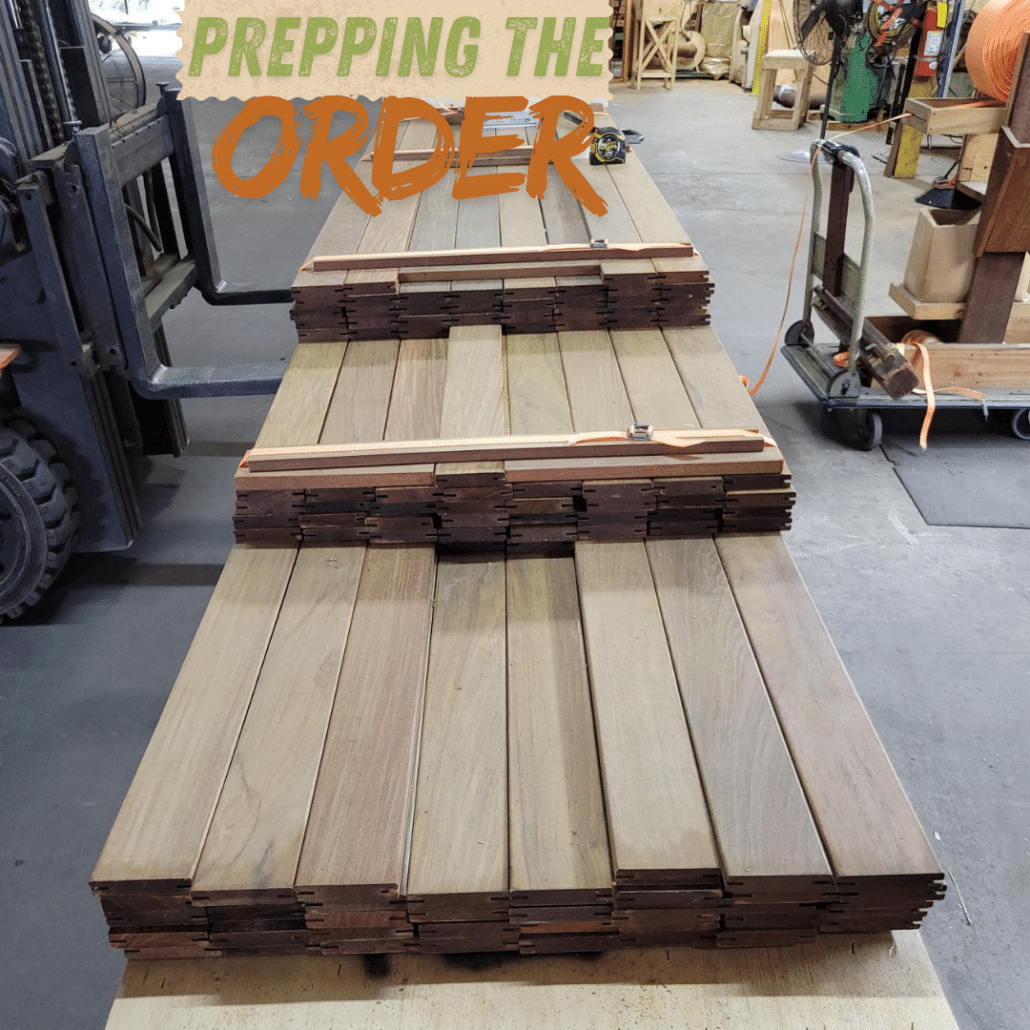
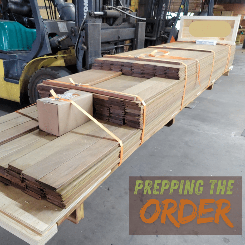
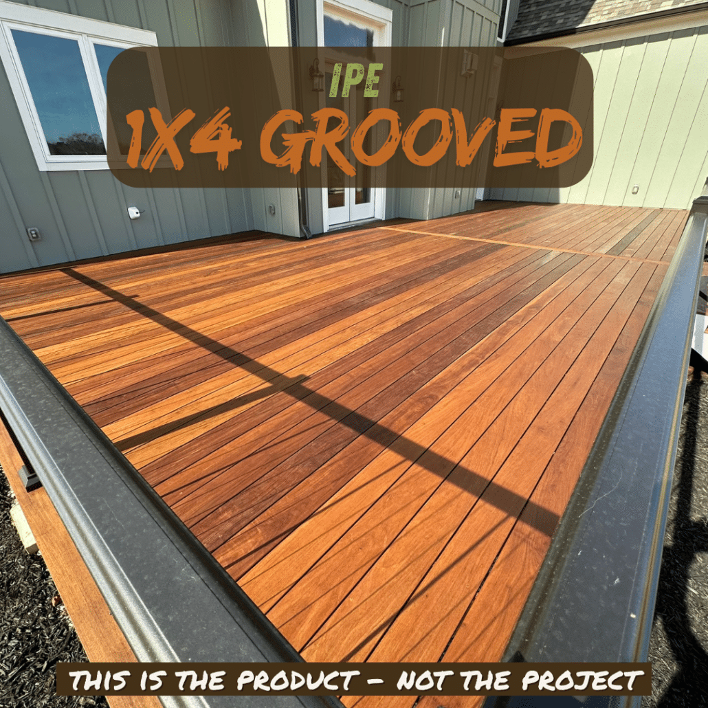
These photos feature Ipe 1×4 grooved decking boards being carefully prepped and crated for cross-state delivery. Ipe’s rich chocolate-brown tones, fine grain, and extreme density make it one of the most reliable hardwood decking options available. Every order is reinforced for protection, sealed against moisture, and inspected before leaving our Atlanta warehouse — part of why BWD maintains one of the best zero-damage records in the industry.

Ipe decking is celebrated for its longevity, resistance to decay, and natural strength, making it ideal for Chicago’s demanding seasonal climate. Its tight grain and dense structure ensure stability year-round — from snowy winters to humid summers.
Homeowners and builders alike choose Ipe for luxury outdoor spaces that combine performance, beauty, and sustainability.
✅ Learn more about Ipe’s environmental stewardship: What Is Ipe Wood and Is It Sustainable?
✅ See how we protect every order: Shipping & Crating Video

